Smartphones, AI and 5G: how Finistère reinvents road maintenance
Published on : 25/02/2026

5mn reading time
Thanks to an onboard smartphone, artificial intelligence, and Orange’s 5G network, the Finistère department is experimenting with a new way to monitor the condition of its roads. A detailed, real-time mapping that promises more preventive, objective, and efficient maintenance on a territory heavily exposed to weather conditions.
Crédits vidéo : Orange, vialytics
The Finistère department has experimented 5G

Sector of activity
Road infrastructure and road maintenance

Business needs
To have an accurate, fast, and automated system to monitor the condition of roads in real-time, in order to anticipate deterioration and optimize maintenance.

Solutions
A combination of onboard smartphone, artificial intelligence, and 5G connectivity to analyze and continuously map the condition of roads, with instant data transmission.

Benefits of 5G
Massive data transmission on the move, in real-time, enabling continuous, reliable, and uninterrupted monitoring, even in isolated or hard-to-access areas.
In Finistère, AI and 5G are putting roads under the scanner
A territory on the front line
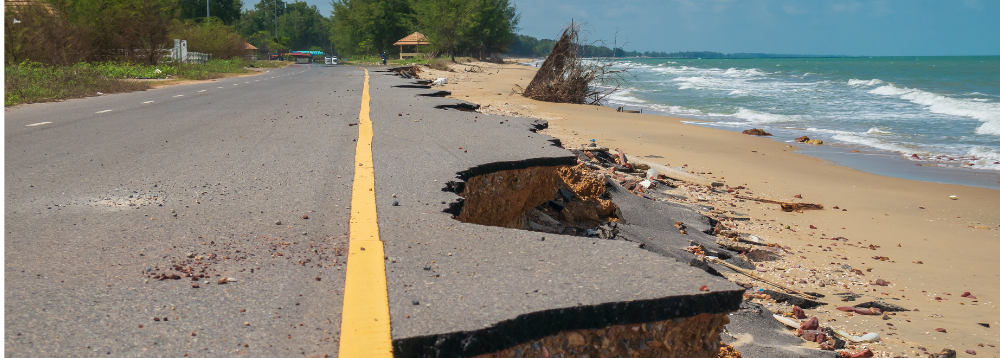
Wind, sea spray, repeated rains: in Finistère, the wear and tear of the road network is rapid and sometimes invisible to the naked eye. For a long time, its monitoring relied on human inspections, which were costly and sometimes imprecise… Until the department decided to test an alternative approach. By combining the vialytics solution, a specialist in automated pavement condition analysis, with Orange’s 5G network, Finistère is testing a new surveillance chain where artificial intelligence, onboard smartphone, and 5G work together.
The goal? To accurately map the entire road network and shift from one-off inspections to continuous monitoring, which is more reliable and reactive.
The aim is for the department to have, as easily as possible, a true health status of its road network,” summarizes Jean-Jacques Gaouyer, Director of Innovation for Brittany-Loire Valley at Orange. “The main concern is ensuring people’s safety. A pothole can quickly become very dangerous, in both urban and rural areas.
Fine surveillance, informed decisions
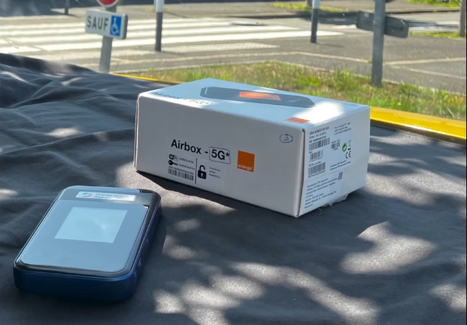
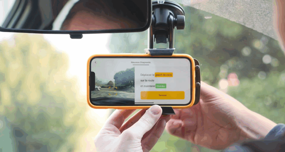
Concretely, the experiment relies on a deliberately minimalist setup. A smartphone – mandatory (with or without a SIM card) embedded in the vehicle, along with a dedicated application. While driving at moderate speed, the smartphone captures an HD image of the roadway every four meters, and the data, thanks to the 5G connection (here via an Orange Airbox 5G), are immediately transmitted to the cloud, where artificial intelligence analyzes them.
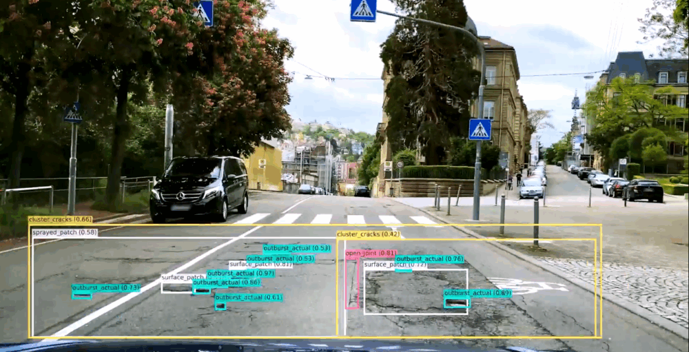
We automatically collect thousands of photos, without human intervention,” explains Hervé Villemagne, vialytics’ French commercial director. “The algorithm classifies damages, weighs them, and then produces a very readable map: green when the pavement is healthy, red when degraded, with detailed images accessible.
For the department’s teams, the difference is clear.
The vehicle drives, films the entire road segment, and AI provides a clear diagnosis,” confirms Éric Jousseaume, mayor of Île-Tudy in the southern tip of Finistère. “It allows us to quickly identify the most vulnerable areas and prioritize.” Cracks, subsidence, potholes: the algorithm immediately recognizes the main damages and provides a real decision-making tool. “This saves a lot of time,” he emphasizes.
But beyond time savings, the experiment also signifies a methodological shift.
“Previously, the diagnosis relied on the agents’ visual assessment. And naturally, everyone has their own sensitivity,” observes Hervé Villemagne. “Now, we introduce an element of objectivity. The algorithm works the same everywhere, and decisions are based on precise data.”
A common foundation that helps the community better prioritize interventions, estimate costs, and anticipate work, rather than just managing emergencies.
5G as a prerequisite
And while the promise of this experiment is appealing, it fundamentally depends on a major technical prerequisite: the ability to transmit a massive volume of data, on the move, in a short time. This is where 5G becomes crucial.
We needed a high data flow, sent from anywhere on the field,” recounts Éric Jousseaume. “Before 5G, agents had to bring their smartphones to a control center, wait for data transfer, then return the next morning. It was a very limiting technological dead-end.”
With 5G, this bottleneck is eliminated: images are transmitted continuously, directly from the vehicle
We’re talking about image processing with very compact equipment, onboard a moving vehicle,” recalls Jean-Jacques Gaouyer. The challenge: ensuring that capturing and transmitting images faithfully reflect the reality on the ground.
The essential condition was network coverage. And it was sufficient for the results to be usable across the entire territory,” emphasizes Éric Jousseaume
A key performance in a large department where coastal roads alternate between urban, rural, and sometimes isolated zones.
A second condition: ease of use
Another key point: simplicity. “The idea was for the solution to be as smooth as possible,” insists Jean-Jacques Gaouyer. Once the equipment is connected, it is immediately user-friendly and does not complicate agents’ daily routines.
We didn’t need extensive training,” confirms Éric Jousseaume. “They mainly gained in comfort and in the reliability of the information.
And tomorrow?
For vialytics, the experiment doesn’t stop at simple diagnostics. “
We are now working on predictive analysis and automated work recommendations,” indicates Hervé Villemagne. “The idea is to become a solution provider, not just an observer.
For Orange, the perspectives go far beyond road maintenance:
We can imagine the same system applied to the health status of public buildings, hydroelectric parks, wind or solar farms, which are difficult to monitor today,” projects Jean-Jacques Gaouyer. “We could inspect these sites via connected drones using 5G.
By then, this experiment, which lasted a few weeks and is now over, will have made it possible to explore a potential path: that of continuous road monitoring, where 5G and AI could, in time, play a discreet yet structuring role in public action. An innovation with a low profile, but a high impact, on roads that everyone uses, often without paying attention.
To go further
• Smart City – how will 5G make our cities even smarter?“
• Article : “5G and innovation are making cities smarter and more resilient“

Subscribe to our Orange 5G Lab newsletter